3D Building & Laser Scanning in Ontario
Building reality capture that brings existing conditions into the design process through detailed three dimensional point clouds.
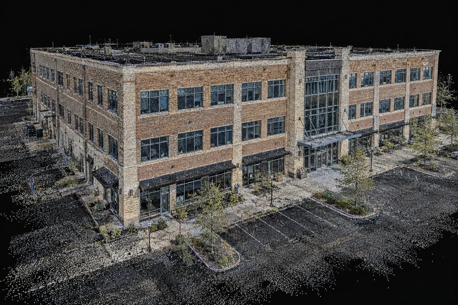
JSR Engineering provides 3D building scanning for commercial and residential projects across Ontario. Using FARO scanning equipment, we capture visible building geometry to support renovation design, existing condition documentation and coordination between design disciplines.
Interior & exterior building reality capture
Laser scanning records visible surfaces as spatial measurements. Interior capture can document room geometry, structural elements and exposed services. Exterior capture can record facades, entrances and the building form. Capture planning accounts for access and sight lines so the resulting dataset suits the intended use.
Registered point clouds & E57 / LAS exports
Individual captures are processed and registered into a coordinated point cloud. Deliverables can include E57 and LAS files for use in compatible design and modelling software. The export format and level of documentation are selected around the project workflow rather than treated as a single standard output.
As built documentation for renovation design
Point clouds provide a reference for developing measured drawings and understanding existing building geometry. They are particularly useful when earlier drawings are incomplete or no longer reflect the space. Scanning supports documentation of visible conditions; concealed elements and their structural capacity require separate investigation.
3D Building Scanning services
- Commercial building interior and exterior scanning
- Residential and small building reality capture
- Registered colour point cloud datasets
- E57 and LAS point cloud deliverables
- Existing condition and as built drawing support
Laser scanning as a foundation for renovation planning
Existing buildings often differ from older drawings. Laser scanning captures visible geometry as a point cloud that can be used to understand room arrangements, building exteriors and accessible service spaces. This provides a shared reference for design teams planning alterations. The intended use of the data guides the capture approach and the level of documentation needed for the assignment.
Related project experience
Explore our existing building assessment experience for an example of JSR Engineering’s project scope.
Learn more about FARO as built capture and modelling applications.
Related design services
- Architectural & BCIN Design
- Structural Design
- Mechanical & HVAC Design
- Electrical Design
- Fire Sprinkler Design
Frequently asked questions
Is a point cloud the same as a finished CAD drawing?
No. A point cloud is a spatial dataset of measured points. CAD drawings or a building model are separate deliverables developed from that information when they are included in the project scope.
Can laser scanning show concealed building elements?
Laser scanning records surfaces visible to the instrument. It cannot establish the condition or arrangement of elements behind closed walls or other obstructions. Access and visibility therefore affect what can be documented in the resulting point cloud.
How are point clouds used with design drawings?
Registered point clouds can serve as a reference for measured drawings and design coordination. E57 and LAS exports support data exchange, while the preparation of finished CAD drawings or models is a separate deliverable defined for the project.
Discuss your next project.
Connect with JSR Engineering about building design, engineering or reality capture services for your project.
Contact us